
Finding Who Lives on a Washington Street
Street research starts with an address, not a guessed name. In Washington, the county GIS and Assessor can identify a parcel and its property relationship. The Recorder can connect that parcel to a deed party. Utah voter data and historical directories may add a dated household lead, but each source describes a different record role. Keep owner, occupant, voter, mailing address, and historical listing separate.
A practical Washington street directory walk follows the same order each time:
- Normalize the house number, directional, street name, type, unit, city, state, and ZIP with USPS.
- Open the Washington County GIS or Recorder viewer, select the parcel, and note parcel/account/TAX_ID, subdivision, address point, and map date.
- Use the Assessor report route for ownership, situs and mailing context, images, sketches, value, and characteristics when displayed.
- Search the Recorder by parcel or legal description, party role, book/page, document type, and recording or document date.
- Use the controlled voter request or historical library shelf only when the question calls for a dated resident or household lead.
Stop when the next step would require protected information. A map hit can establish geography. It cannot establish that a named owner sleeps at the property.
Washington Records Searchable by Street
Several Washington records are keyed to a parcel, address point, street, or legal description. They do not all describe people in the same way. Use the coverage table to choose the source that fits the question, then retain the office, date, and field names beside the result.
| Record Set | Keeper | What It Shows | Access |
|---|---|---|---|
| Assessor/property report | Washington County Assessor | Ownership, situs/mailing relationship, property details | Public viewer; exact fields vary |
| GIS parcel and address layer | Washington County GIS / city maps | Parcels, street grid, ZIP, subdivision, zoning, flood, aerial | Public viewer and REST metadata |
| Recorder deed index | Washington County Recorder | Grantor, grantee, instrument, book/page, date, legal description | Index and copy routes |
| Voter data request | Utah Elections / County Clerk | Allowed public fields by scope, precinct, or district | Formal request, fee, privacy rules |
| Permit or code record | Washington City Building / Code | Applicant, owner, contractor, inspection or notice trail | City Inspect or defined GRAMA request |
| Historical address reference | Library, WCHS, Utah Tech | Dated household or occupant lead | Reference request; local run not confirmed |
The parcel or TAX_ID is the bridge between modern map context and a Recorder search. A legal description is stronger than a changed street number for older instruments. City Inspect is the local permit workflow; Code Enforcement describes report, inspect, notice, reinspect, citation, and close steps but exposes no public case-search portal. Request a date-bounded record rather than treating a missing online result as proof that no permit exists.
The Washington County GIS map inventory identifies the address, ZIP, parcel, assessor, recorder, historic, and development layers.
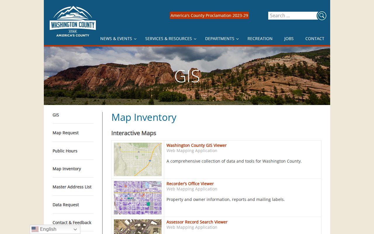
That inventory is the best starting point for choosing a layer before walking a street.
Washington Assessor Fields Matter
The Washington County Assessor Record Search Viewer is documented as a public property-report viewer, yet the precise live query labels were not exposed in the inspected source. The county parcel layer confirms a more specific field set and functions. Read both sources with that distinction in mind.
| Field or control | Street-directory meaning |
|---|---|
| Parcel Number/TAX_ID and Account Number | Stable property identifiers to carry into another county search. |
| Subdivision Name | Platted context, not an HOA membership claim. |
| Ownership | Record relationship; never label it occupant without evidence. |
| Image and property report | Official linked inspection paths, with redaction and access limits. |
Situs is the physical parcel address. Mailing is where notices go. The two may differ, and neither field alone identifies every household member. The county’s map inventory also includes historic parcel and aerial layers from documented years, which can help explain a changing block without naming people in an image.
The county parcel layer metadata shows the property identifiers and ownership-report functions used in the street workflow.
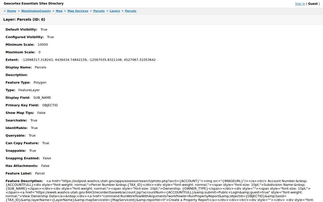
It confirms the map-to-report path without turning the layer into a resident roster.
Washington’s Right-Angle Address Grid
Washington City’s history describes a straight, wide, right-angle street plan established with the 1857 settlement. The county AddressSystems service includes Washington City grids and quadrants, while the GIS viewer supplies street centerlines and address points. That combination makes an intersection, quadrant, and parcel cross-check practical for a Washington street directory.
No official source located a definitive street-renaming or street-renumbering timeline. For an old number, preserve the original spelling, search newspapers and WCHS material, compare the legal description and abstract, then document the bridge to the modern address. Never silently “correct” an old address.
The Washington County AddressSystems map provides the county’s address-grid context.
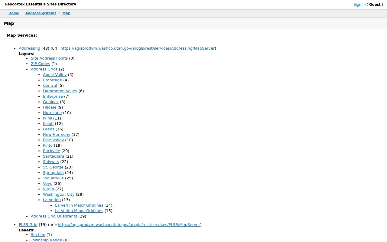
Use it to compare a historic street reference with a current grid, while keeping any unresolved bridge marked.
Note: A postal ZIP confirms delivery geography, while a city limit, parcel, subdivision, and census area each describe something else.
Street Layers Show More Than Names
The Washington County GIS viewer can place parcels, address points, subdivisions, street lines, ZIP Codes, city limits, flood zones, zoning, ownership, historic parcels, and aerial imagery in one geographic frame. The city map gallery adds historic sites, cemetery names and plots, facilities, parks, trails, voting districts, and other civic layers. Map accuracy disclaimers and map-order fees apply, so note the layer date and source.
For a street study, start with the address point, click the parcel, and record the official report path. Then compare the subdivision and city-limit layers. Use flood or zoning only as neighborhood context. A layer that overlaps an address does not create a resident, household, or association record.
Deeds Along a Washington Street
The Washington County Historical Record Search exposes fields for arbitrary terms, party, search value and match, party name and role, clerk book and page, document type, recording, filing and document dates, parcel, page, and book or volume. Search a parcel or legal description first, then use a known party role. Grantor means the party transferring an interest; grantee means the party receiving it.
For a whole street, do not build a public household list. Use map-browse to understand the parcel sequence, then search a defined parcel or instrument when a deed question exists. Copies may carry fees, and the Recorder’s recording requirements govern format, margins, signatures, legal description, delivery, and current fee or redaction rules.
The Washington County historical record search displays the party, parcel, book, page, document, and date search route.
The application was captured as a loading shell, so the documented field inventory is more reliable than an assumed result screen.
Washington Permits Need a Request
Washington City routes current building and inspection work through City Inspect. The research source describes an account, permit and inspection workflow, PDF uploads, and a next-business-day inspection rule when submitted by 5 p.m., but it does not expose exact public search fields. Code Enforcement provides its standards-of-living process and contact, not a public case index.
A GRAMA request can name a street address or parcel, permit range, work type, applicant, approval, inspection, renewal, or final disposition. Keep owner, applicant, contractor, and permit roles distinct. A permit event tells you about regulated work, not who lived there.
The Washington County GIS viewer shows how street, parcel, zoning, flood, subdivision, and aerial context can be read together.
Map layers add context for a permit request, but they do not replace the city’s permit custodian.
Old Street Directories Are Limited
Library, WCHS, and Utah Tech can help with a historical address-to-occupant question. WCHS lists regional gazetteers and Washington County News from 1908–1923. The Washington County Library offers local-history reference help and Heritage Quest with a current county barcode, and Utah Tech holds WASH-046 historical-society files, oral histories, maps, photographs, and civic records.
No official Washington City reverse or criss-cross run was located. A criss-cross directory is an address-to-name tool, often useful for a past household, but its absence is a research result. The Washington city directory collections page handles the historical shelf; this street directory stays focused on present parcel and address methods.
The Recorder parcel and owner map is the county’s direct property-map route.
It belongs beside a defined deed question, not beside an inferred list of people on a street.
What a Street Directory Cannot Show
Public street records do not index every household member, utility customer, delivery recipient, or private association member. DMV address information is restricted. A business or service address is not a home. The Assessor’s ownership label is not an occupant field, and a voter record may be withheld or protected under current Utah rules.
Lawful use. Washington address records may support personal, lawful research, family history, or property questions. Repeatedly monitoring, approaching, or using records to stalk, harass, threaten, or intimidate a person can cross Utah’s anti-stalking and victim-privacy boundaries.
- Situs address
- The physical location of the parcel.
- Plat
- A recorded map that relates lots, blocks, and subdivisions.
- Parcel
- A property unit, not a list of people living there.
- Criss-cross directory
- A historical address reference whose Washington City run was not located.
Use the Washington street directory as a source map. Keep exact private-home details out of public presentation, do not join protected voter or Safe at Home data to a parcel, and route corrections to the office that created the record.